
There is something quite special about Kalk Bay’s relationship with the mountain. From the harbour, cafés and little shops along Main Road, you can look up towards the sandstone slopes rising behind the village. Follow one of the trails into those mountains, and before long the rooftops give way to fynbos, forest and wide views across False Bay.
For those who enjoy exploring on foot, Kalk Bay offers access to some wonderful hiking routes along the southern stretch of Table Mountain National Park. There are short walks for a relaxed morning outdoors, more demanding climbs towards the peaks above the coastline, and trails that take you through a landscape that feels surprisingly far removed from the village below.
We’ve put together a guide to some of the best hikes near Kalk Bay, including where to start, how long to allow, what to expect along the way and a few practical things worth knowing before heading out.
Hiking trails near Kalk Bay at a glance
| Trail | Distance | Time | Difficulty | From Dalebrook Place |
|---|---|---|---|---|
| Kalk Bay Peak & Spes Bona Forest | Approx. 6.9 km loop | 3.5–4 hours | Moderate to strenuous | About 6 min by car, or 20 min on foot (uphill) |
| Muizenberg Peak via Pecks Valley | Approx. 5 km return | 2–2.5 hours | Moderate | About 10 min by car |
| Elephant’s Eye Cave, Silvermine | Approx. 5–6 km return | 2–3 hours | Easy to moderate | About 20 min by car |
| Silvermine Waterfall Trail | Approx. 4.5–5.1 km return | 1.5–2.5 hours | Easy to moderate | About 20 min by car |
| Silvermine Dam Boardwalk | Short boardwalk walk | Allow 20–45 minutes | Easy | About 20 min by car |
Distances and times are planning estimates, not fixed measurements. They depend on the exact trail variation, walking pace, weather and stops along the way. For mountain routes, carry an offline trail map.
The first two hikes start on Boyes Drive, just above the village, with roadside parking and no gate. The three Silvermine walks are about 20 minutes’ drive away over Ou Kaapse Weg, so you’ll want a car for those. Silvermine charges a SANParks conservation fee, and there are no card machines at the gates, so take cash.
1. Kalk Bay Peak and Spes Bona Forest: A Mountain Adventure Above the Village
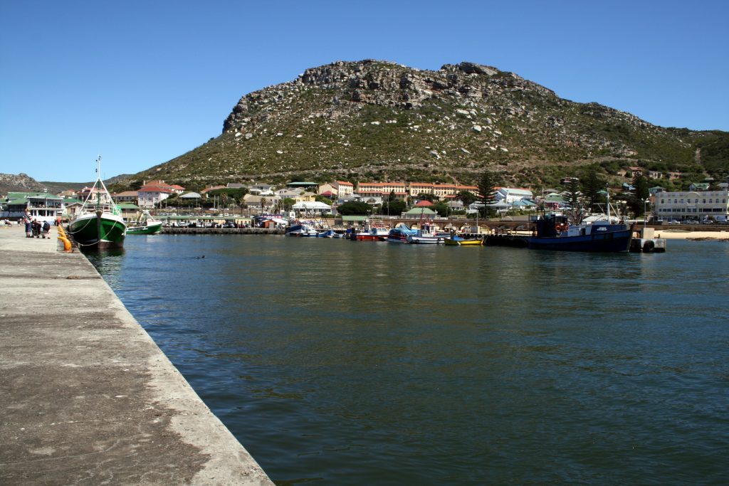
For hikers looking to spend a few hours properly immersed in the mountains above Kalk Bay, the Kalk Bay Peak and Spes Bona Forest loop offers a beautiful combination of open mountain terrain and sheltered indigenous forest.
The route begins above St James on Boyes Drive, climbing through rocky fynbos-covered slopes towards Kalk Bay Peak. Along the way, there are views over the False Bay coastline and the villages tucked between the mountain and the sea.
One of the pleasures of this hike is how the landscape changes. The exposed mountain sections eventually give way to the cooler, greener environment of Spes Bona Forest, where the path winds through indigenous trees before returning towards the starting point.
Trail details
- Start and finish: Ou Kraal, Old Mule Path trailhead, Boyes Drive, St James
- Route: Circular via Mimetes Valley, Kalk Bay Peak area and Spes Bona Forest
- Distance: Approximately 6.9 km
- Duration: 3.5–4 hours
- Elevation gain: Approximately 447 m for this particular loop
- Difficulty: Moderate to strenuous
- Terrain: Rocky mountain paths, uneven steps and forest sections
The route is best suited to hikers with some experience and a reasonable level of fitness. There are several connecting paths across this part of the mountain, so it’s worth downloading the specific loop beforehand rather than relying on signs at every junction.
For the route description and mapped trail details, see the Kalk Bay Peak and Spes Bona hiking guide.
2. Muizenberg Peak via Pecks Valley: Big Views Across False Bay

A little further along Boyes Drive, Muizenberg Peak offers another rewarding way to explore the mountains above the coast.
The trail begins at the Pecks Valley entrance on Boyes Drive, above Lakeside. The initial climb is fairly steep, but the route gradually opens out onto the mountain slopes, with views towards Muizenberg, the long curve of False Bay and the coastline beyond.
It’s a good choice for those who enjoy a moderately challenging morning hike without committing to an entire day on the mountain. The upper sections are exposed, so the weather can make a considerable difference to the experience.
Trail details
- Start and finish: Pecks Valley trailhead, Boyes Drive, Lakeside
- Route: Out and back towards Muizenberg Peak
- Distance: Approximately 5 km return
- Duration: 2–2.5 hours
- Elevation gain: Approximately 350 m
- Difficulty: Moderate
- Terrain: Steep sandy sections, rocky paths and exposed mountain slopes
The trail has several junctions and isn’t consistently marked. An offline map is particularly important here, and it’s best to avoid the upper mountain in strong wind or low cloud.
For further route information, see the Muizenberg Peak trail guide.
3. Elephant’s Eye Cave: A Rewarding Hike Through Silvermine
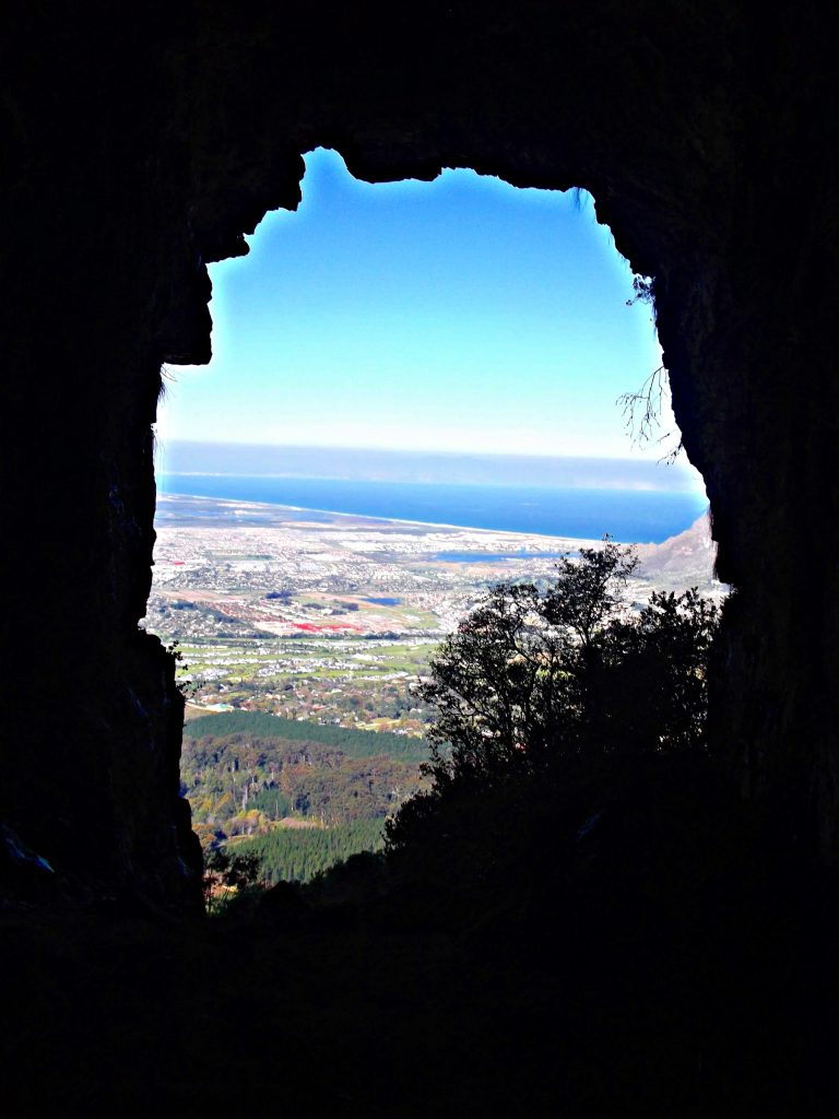
Elephant’s Eye is a popular hike in the Silvermine section of Table Mountain National Park, and a lovely option for those who want to spend a few hours outdoors without tackling one of the Peninsula’s longer climbs.
The trail starts near Silvermine Dam and follows a combination of gravel tracks and mountain paths through open fynbos. The final section climbs more steeply towards a large sandstone cave, where the landscape opens out across the Constantia and Tokai valleys.
The cave takes its name from its position on the mountainside, which, when viewed from a distance, resembles the eye of an elephant.
Trail details
- Start and finish: Silvermine Dam parking area, Gate 1, Ou Kaapse Weg
- Route: Out and back to Elephant’s Eye Cave
- Distance: Approximately 5–6 km return
- Duration: 2–3 hours
- Elevation gain: Around 300 m, depending on the route
- Difficulty: Easy to moderate, with a steeper final ascent
- Terrain: Gravel tracks, sandy paths and rocky sections near the cave
- Entry: SANParks conservation fee applies
The route is exposed to the sun for much of the walk, so take sufficient water and sun protection. There are also drops around the cave entrance, making care especially important when hiking with children.
The Silvermine section has limited mobile reception, and there have been reported security incidents on some trails. Hiking in a group and checking current park advisories are sensible precautions.
For more detail, see the Elephant’s Eye hiking guide and SANParks Silvermine information.
4. Silvermine Waterfall Trail: A Walk Through Fynbos to a Seasonal Waterfall
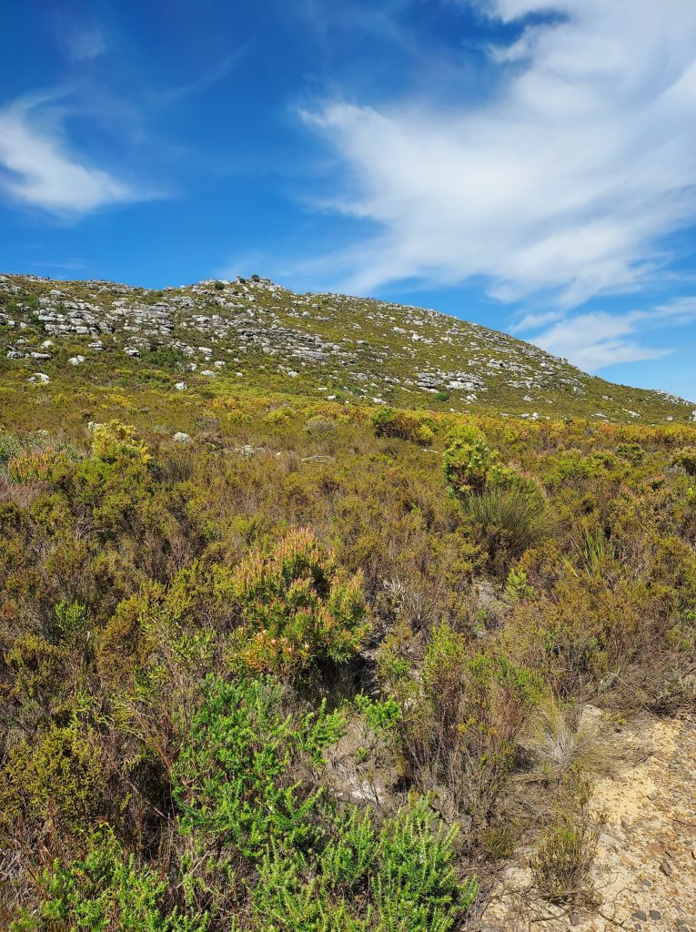
On the other side of Ou Kaapse Weg, Silvermine offers a different kind of mountain outing. Here, the trails wind through open fynbos and rocky valleys, with a seasonal waterfall tucked into the landscape.
The Silvermine Waterfall Trail is particularly appealing after good rainfall, when water moves down the sandstone slopes. At drier times of year, the waterfall may be reduced to a trickle or dry altogether, but the surrounding mountain scenery is still worth exploring.
The walk begins from the Gate 2 parking area, following the mountain path towards the waterfall. The approach becomes rockier near the falls, and care is needed around wet surfaces and exposed edges.
Trail details
- Start and finish: Silvermine Gate 2, Ou Kaapse Weg
- Route: Out and back to the waterfall
- Distance: Approximately 4.5–5.1 km return, depending on the route taken
- Duration: Allow 1.5–2.5 hours
- Difficulty: Easy to moderate, with rocky sections near the waterfall
- Terrain: Mountain paths, fynbos slopes and uneven rocks
- Entry: SANParks conservation fee applies
SANParks currently lists Gate 2 parking access from 08:00 to 18:00 throughout the year. As access arrangements can change, it’s worth confirming before visiting.
The waterfall is seasonal, and visitors should avoid approaching exposed edges, particularly when the rocks are wet.
See Cape Town Tourism’s waterfall hiking guide and SANParks Silvermine for additional information.
5. Silvermine Dam Boardwalk: A Gentle Walk Surrounded by Mountains
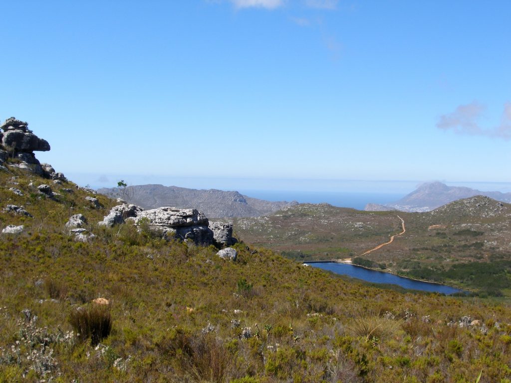
Not every outing needs to involve a climb. Silvermine Dam is a beautiful place to spend a quieter morning outdoors, with a short boardwalk beside the water and mountain slopes rising on either side.
The reservoir sits among indigenous fynbos, and the surrounding landscape changes throughout the seasons. In spring, there are flowering plants to look out for, while cooler mornings can bring low cloud across the hills.
The boardwalk makes this an accessible option for visitors who would prefer a gentle walk, or for those travelling with family members who aren’t keen on a more demanding mountain trail.
Walk details
- Start and finish: Silvermine Dam parking area, Gate 1, Ou Kaapse Weg
- Route: Short boardwalk and paths around the reservoir
- Distance: A short loop around the reservoir
- Duration: Allow 20–45 minutes to explore at a relaxed pace
- Elevation gain: Minimal along the boardwalk
- Difficulty: Easy
- Terrain: Boardwalk and relatively level paths
- Entry: SANParks conservation fee applies
SANParks describes the boardwalk as wheelchair-friendly, although visitors should check current surface conditions and accessibility requirements before travelling. There are also designated picnic areas around the dam, making it an enjoyable place to spend a little longer.
What to Pack for Hiking Around Kalk Bay
Even shorter hikes in the Cape mountains deserve some preparation. Conditions can change quickly, particularly on exposed ridges, and the weather on the mountain isn’t always the same as it is beside the sea.
Before setting off, make sure you have:
- Comfortable hiking shoes with good grip, particularly for rocky or uneven paths.
- Enough drinking water for the length and conditions of your hike, along with snacks for longer routes.
- A hat, sunscreen and sunglasses.
- A lightweight windproof jacket and an additional warm layer.
- A charged phone, offline trail map and power bank if needed.
- A small first-aid kit and any personal medication.
- A daypack to carry everything comfortably, including any rubbish.
For routes with several junctions, a downloaded GPX track or reliable hiking map is particularly useful. Mobile signal can be unreliable in parts of the mountains, so don’t depend on having a connection throughout your hike.
A Few Things Worth Knowing Before You Go
Check the weather. The Cape’s southeasterly wind can make exposed mountain routes unpleasant or unsafe. Low cloud, rain and extreme heat are also good reasons to reconsider a hike.
Choose your route carefully. Some trails have multiple starting points and variations, which can change both the distance and difficulty. Know where you intend to finish before setting out.
Silvermine is still recovering from the fire of April 2025. The trails reopened later that year, but some trail markers may still be missing, so keep to the main paths.
Hike with others. Mountain safety is an important consideration around Cape Town. Avoid hiking alone, favour established and busier routes, and check current safety notices with SANParks.
As David Nel of Wilderness Search and Rescue put it this winter: “Whether you’re heading out for a short hike or a training run, never underestimate how quickly circumstances can change.”
Allow enough daylight. Start with sufficient time to complete your route comfortably, including stops and the return journey.
Respect the mountain. Stay on established paths, leave plants and wildlife undisturbed, and take everything you bring back down with you.
For current park access information, conservation fees, restrictions and safety guidance, consult SANParks before your hike. The Table Mountain National Park emergency number is 086 110 6417, and Wilderness Search and Rescue is on 021 937 0300.
From Mountain Trails to Village Life
One of the things we love about Kalk Bay is how naturally a day outdoors becomes part of village life.
You might start your morning on the mountain, looking down across False Bay, and return to find Main Road beginning to fill with people heading for coffee, browsing the independent shops or meeting friends for breakfast.
After a longer hike, there’s something especially appealing about settling into a café, wandering down towards the harbour or taking a dip in the Dalebrook tidal pool.
And with so many of these experiences within easy reach of one another, there’s no need to plan every hour of the day.
For visitors who enjoy combining time outdoors with good food, coastal walks and a neighbourhood full of character, Kalk Bay makes a wonderful base for exploring Cape Town’s Southern Peninsula.
Stay in Kalk Bay and Explore at Your Own Pace
At Dalebrook Place, you’re well positioned to experience both sides of Kalk Bay: the village and coastline on your doorstep, and the mountain trails waiting just above.
Our self-catering apartments offer a comfortable base for a few days of exploring, whether you’re visiting for a hiking weekend, an extended stay or simply a change of scenery along the False Bay coast.
Planning a hiking weekend in Kalk Bay?
Stay at Dalebrook Place, with the mountains, ocean and village life all within reach.